About Us
We are a precise Global Navigation Satellite Systems (GNSS) supplier focused on a broad range of marine survey accuracy products and Satellite Signal correction services in the sub-Saharan Africa Region. An additional range of complimentary products provide a client solution for marine and inland water hydrographic requirements.

Marine Positioning Solutions
Heading & positioning solutions for inland, nearshore, and offshore applications
GNSS Receiver Hardware
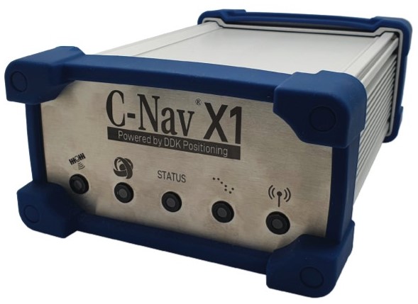
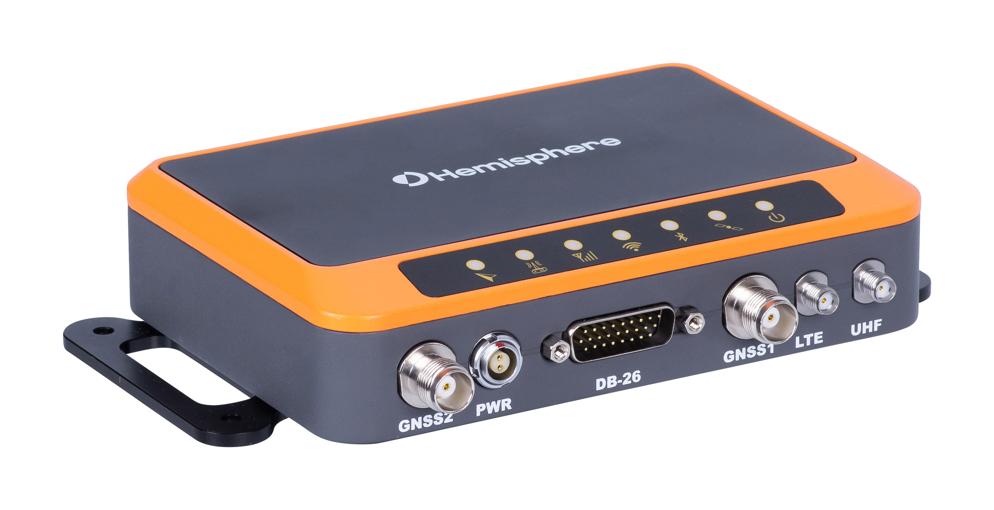
C-NavX1™ GNSS Receiver
The C-NavX1 is a quad-band GNSS receiver built to deliver precise positioning for the most challenging of marine operations. Supports decimeter-level mulit-constellation positioning utilizing the latest C-NavMAX correction service delivering precise positioning from pole to pole through the Iridium® LEO satellite communications network.
Vector™ VS1000 GNSS Receiver
Oceaneering is an authorized reseller of the Vector VS1000, Hemisphere® GNSS’ premiere multi-GNSS, multi-frequency receiver designed specifically for the professional marine market. Providing precise heading, Athena RTK positioning, and full Atlas capability, its rugged design is compliant to IP67, MILSTD-810G, MIL-STD-202F, and IEC 60068-2 standards.
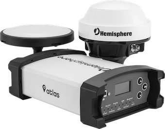
R632 GNSS Receiver
The new R632 GNSS receiver is a full- solution product in an incredibly compact and powerful package, offering the ability to easily upgrade to an astounding 0.01° accurate heading. Built on the foundation of Hemisphere’s new Lyra, Cygnus and Aquila core technologies, the R632 offers amazing new interference rejection and multipath mitigation. The result is an exceptional combination of performance, communications, and connectivity.
Vector™ V500 GNSS Smart Antenna
Hemisphere® GNSS’ all-in-one multi- frequency, multi-GNSS smart antenna which provides RTK-level position and precise heading. This rugged design is sealed for the harshest environments and is a great solution for professional marine and other challenging applications.
SATELLITE CORRECTION SERVICES
Antennas
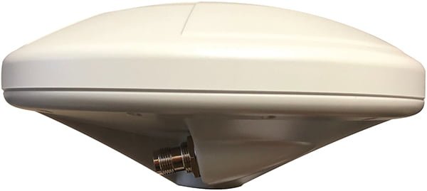
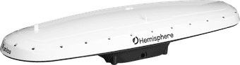
C-Nav289
The C-Nav289 is a GNSS antenna that tracks all GNSS constellations, C-Nav corrections, and SBAS satellites. It has special out of band rejection filters for INMARSAT and IRIDIUM®. It is housed in an all-polymer enclosure for marine application. The antenna is listed in the NOAA GNSS Antenna Calibration tables as C-Nav289.
Controller Software/Hardware
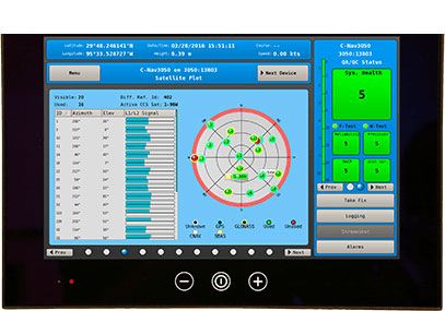
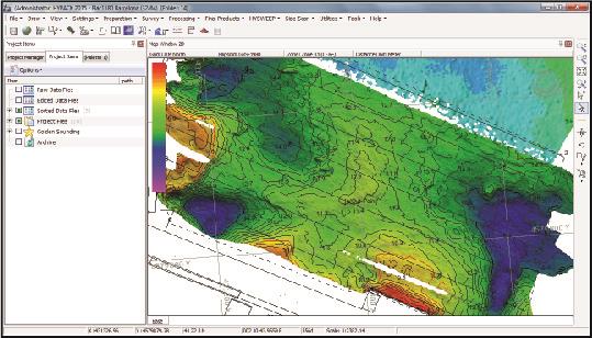
C-NaviGator III
C-NaviGator III software is an intuitive touchscreen controller that provides real-time system accuracy and performance parameters for multiple GNSS receivers. The rugged and reliable wheelhouse-friendly display supports multiple NMEA inputs and outputs. It is fully compliant with the latest guidelines for GNSS positioning within the oil and gas industry per the International Association of Oil & Gas Producers and International Marine Contractors Association.

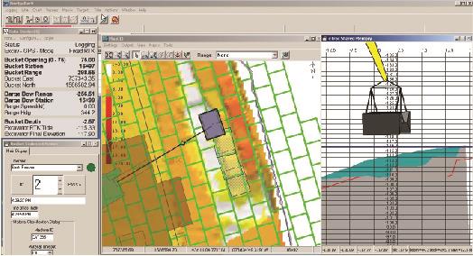
C-Monitor®
The C-Monitor application provides a graphical interface for supervising the operation and performance of one or more differential GNSS systems. It is compliant with the latest QA/QC guidelines for GNSS positioning within the oil and gas industry per the International Association of Oil & Gas Producers (IOGP) and the International Marine Contractors Association (IMCA). The guidelines allow for pre-set user-defined alarm settings or limits, which can be set using the C-Monitor application.
Complimentary Hydrographic Solutions
Hardware and Software for precise marine applications
Teledyne Marine
Beginning as a small collection of unique marine solution providers and expanding to a powerhouse of highly engineered, high performance solutions for a broad range of markets, Teledyne Marine now offers the largest breadth of marine technology in the industry.
With technologies divided into 5 core segments; Imaging, Instruments, Interconnect, Seismic and Vehicles, Teledyne Marine sales staff can address not only brand level solutions, but turn-key, customized systems that leverage our full range of technology. Teledynes goal is to provide one-stop purchasing capability, world-wide customer support, and the technical expertise to solve the toughest challenges.